
britannia under the waves
A look at a potential future of the British Isles.
SEE THE MAP IN A HIGH RESOLUTION HERE!!
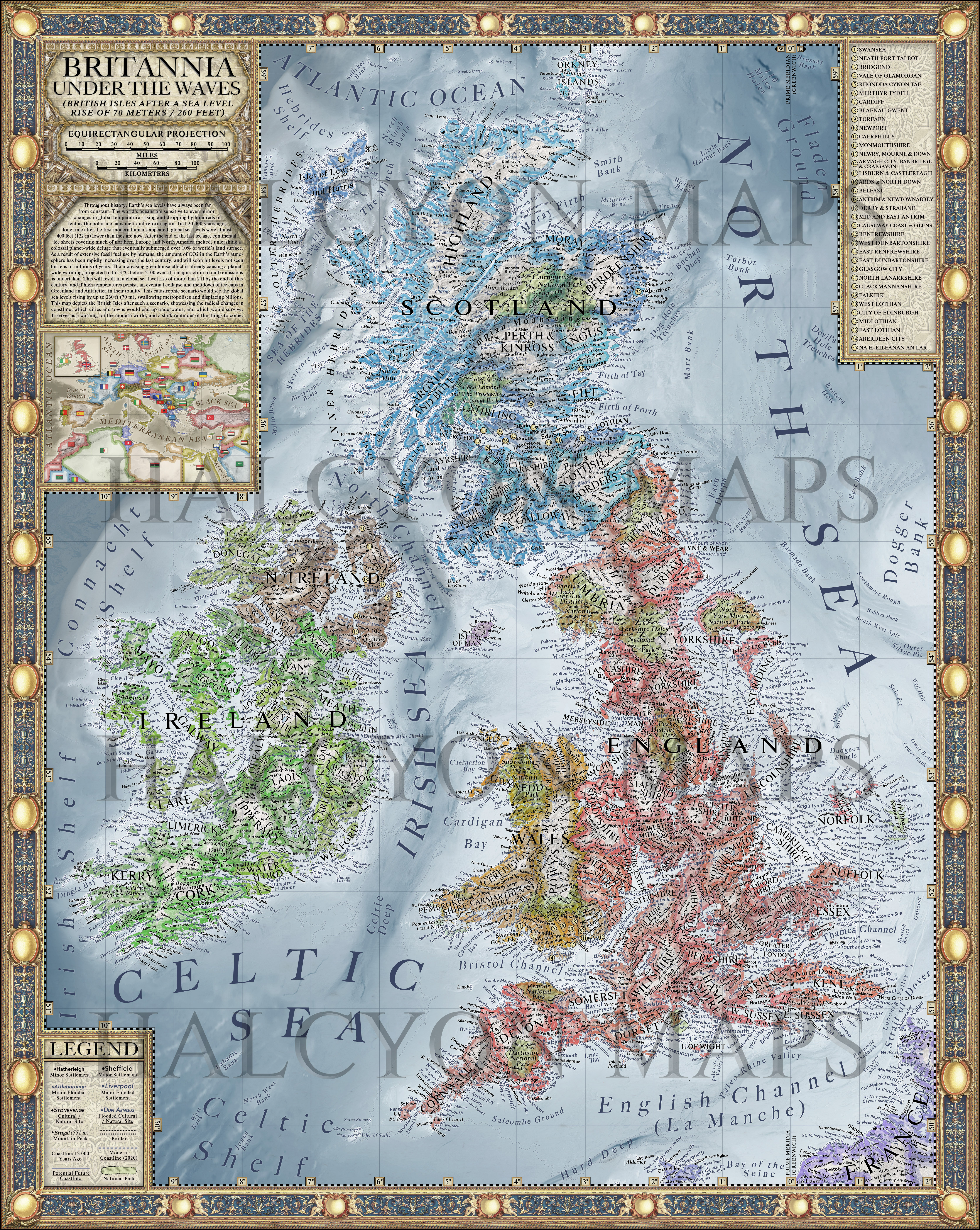
Throughout history, Earth’s sea levels have always been far from constant. The world’s oceans are sensitive to even minor changes in global temperature, rising and dropping by hundreds of feet as the polar ice caps melt and reform again.
Just 20 000 years ago, long time after the first modern humans appeared, global sea levels were almost 400 feet (122 m) lower than they are now. After the end of the last ice age, continental ice sheets covering much of northern Europe and North America melted, unleashing a colossal planet-wide deluge that eventually submerged over 10% of world’s land surface.
As a result of extensive fossil fuel use by humans, the amount of CO2 in the Earth’s atmo- sphere has been rapidly increasing over the last century, and will soon hit levels not seen for tens of millions of years. The increasing greenhouse effect is already causing a planet- wide warming, projected to hit 3 °C before 2100 even if a major action to curb emissions is undertaken.
This will result in a global sea level rise of more than 2 ft by the end of this century, and if high temperatures persist, an eventual collapse and meltdown of ice caps in Greenland and Antarctica in their totality. This catastrophic scenario would see the global sea levels rising by up to 230 ft (70 m), swallowing metropolises and displacing billions.
This map depicts the British Isles after such a scenario, showcasing the radical changes in coastline, which cities and towns would end up underwater, and which would survive. It serves as a warning for the modern world, and a stark reminder of the things to come.
CUSTOMIZABLE WALL POSTERS AVAILABLE FOR SALE NOW!
MY NEW BOOK, VARGIC’S CURIOUS COSMIC COMPENDIUM, IS NOW AVAILABLE FOR SALE!